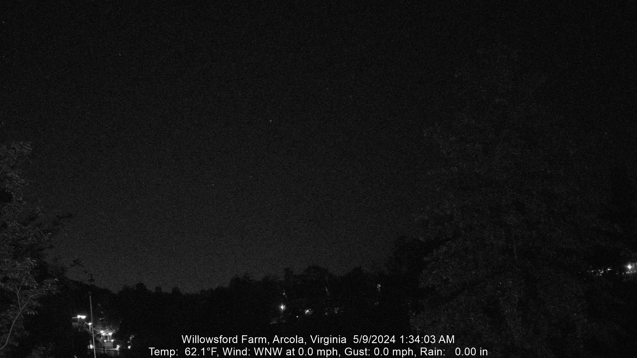
No Warnings, Watches, or Advisories

Latest Image

60-Minute Time Lapse - Updates a couple of minutes after the top of each hour

spacer
Updated: @ 20-Apr-2024 03:01 - next update at 03:10  
Summary / Temperature Wind Rain Outlook
Night time, Dry Night time, Dry
Currently: 53.7°F, Max: 54.2°F, Min: 53.6°F 53.7°F
Colder 0.3°F than last hour.

---

Feels like: 54°F

24-hr difference
-1.8°FColder 1.8°F than yesterday at this time.
  Today Yesterday
High: 54.2°F
00:00
57.2°F
00:00
Low: 53.6°F
02:38
51.7°F
09:06
 Calm SSE
0
Gust:
0 mph
0 Bft - Calm
Today: 0 mph 10:23
Gust Month: 40.3 mph April 13
Rain Today: 0.02 in
Rain Rate (/hr): 0 in
Rain Yesterday: 0.02 in
Storm Rain: 0.04 in
This Month: 1.36 in
Season Total: 12.33 in
8 rain days in April.
Saturday

Saturday: Isolated Rain Showers then Mostly Sunny
Isolated Rain Showers then Mostly Sunny
Humidity & Barometer Almanac Moon
Humidity: 94 % Increased 1.0% since last hour.
Dew Point: 52°F  
Barometer: 29.988 inHg Falling 0.02  inHg/hr
Baro Trend: Falling slowly
Sunrise: 06:27
Sunset: 19:54
Moonset: 05:04
Moonrise: 17:00
Waxing Gibbous
Waxing Gibbous, Moon at 11 days in cycle
88%
Illuminated
UV Index Forecast Solar Radiation
20-Apr-2024
6.5     High 
0 W/m2 (0 %)
High: 0 @  00:00
 NWS Weather Forecast  - Outlook: Overnight & Saturday
Overnight

Overnight: Scattered Rain Showers
Scattered Rain Showers

Lo 52 °F
NWS forecast: Scattered rain showers. Cloudy, with a low around 52. Southwest wind around 3 mph. Chance of precipitation is 40%.
 
Saturday

Saturday: Isolated Rain Showers then Mostly Sunny
Isolated Rain Showers then Mostly Sunny

Hi 68 °F
NWS forecast: Isolated rain showers before 8am. Mostly sunny, with a high near 68. Northwest wind 5 to 16 mph, with gusts as high as 28 mph. Chance of precipitation is 20%.

Free counters!